Log in
All resources
Create a design
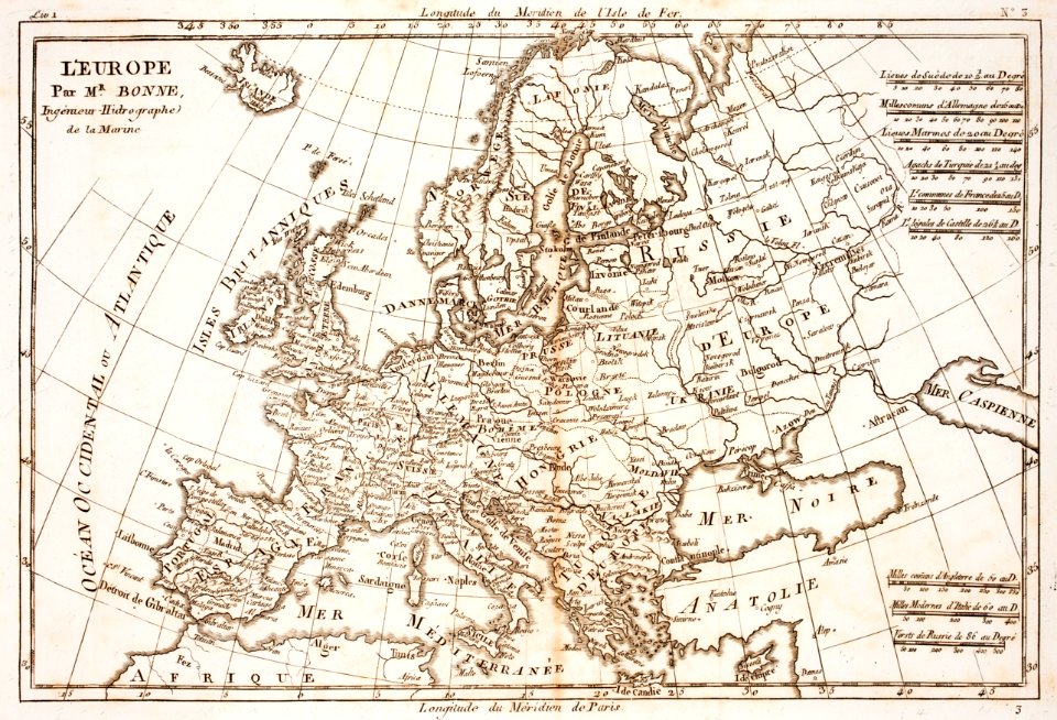
Tools
7,171 Free Images of Atlas Map
drawing
digital library of university of wroclaw
history
historical
cc-pd-mark
pd-old-100-expired
items with otrs permission confirmed
p6305 sdc
cc-zero
prints from bonne atlas de toutes les parties at the peace palace library
atlas géographique des quatre parties du monde (delisle)
18th-century maps of africa
atlas géographique des quatre parties du monde (delisle)
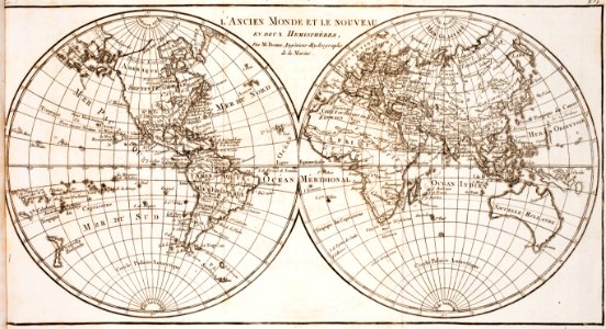
18th-century maps of the world
atlas géographique des quatre parties du monde (delisle)
folded maps
atlas géographique des quatre parties du monde (delisle)
map of italy by guillaume delisle (1700)
atlas géographique des quatre parties du monde (delisle)
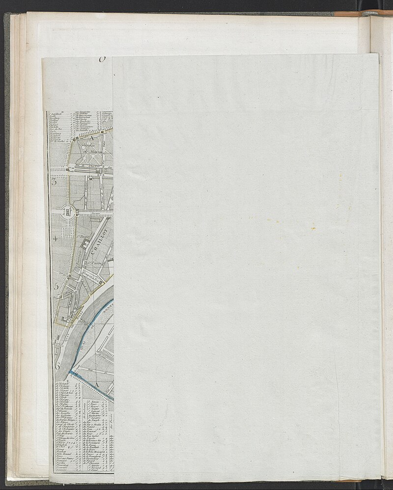
maps of paris by guillaume delisle
historical
history
historical
history
background
maps
map collection of leibniz-institut für länderkunde
maps of liège by baptista van doetecum
map collection of leibniz-institut für länderkunde
maps of liège by baptista van doetecum
historical
history
de praecipvis totivs vniversi vrbibvs, liber secvndvs (1612)
maps of oxford by braun & hogenberg
de praecipvis totivs vniversi vrbibvs, liber secvndvs (1612)
maps of vejer by braun & hogenberg
de praecipvis totivs vniversi vrbibvs, liber secvndvs (1612)
maps of heraklion by braun & hogenberg
de praecipvis totivs vniversi vrbibvs, liber secvndvs (1612)
maps of konstanz by braun & hogenberg
map collection of leibniz-institut für länderkunde
maps of liège by baptista van doetecum
a & c black general atlas of the world
19th-century celestial maps
de praecipvis totivs vniversi vrbibvs, liber secvndvs (1612)
maps of conil by braun & hogenberg
lepidoptera
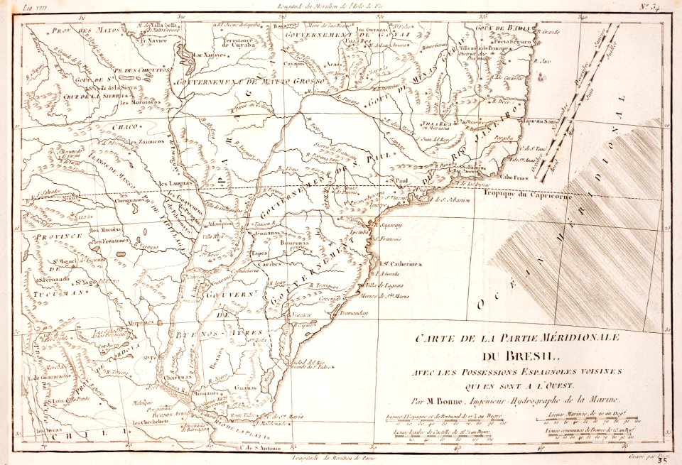
maps
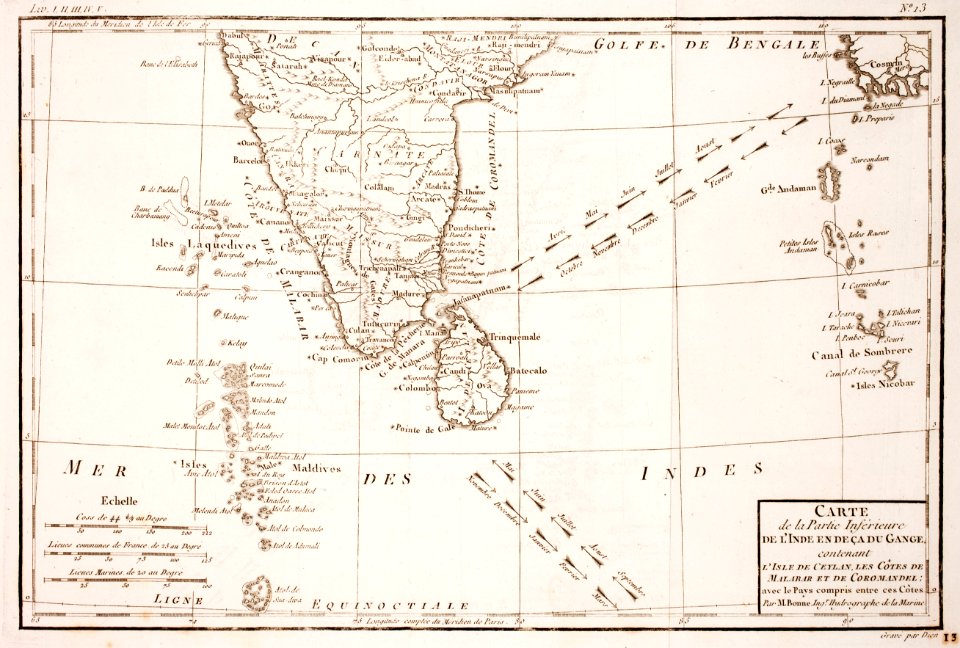
carte des côtes de malabar et de coromandel (1723)
philippe buache
historical
history
prints of cartouches in the rijksmuseum amsterdam
maps in the rijksmuseum amsterdam
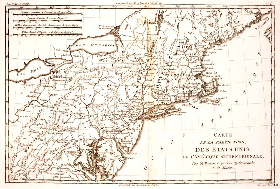
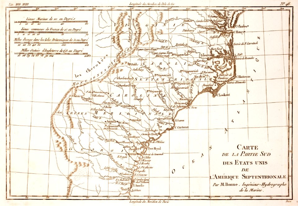
1805 maps of the united states
maps by john cary
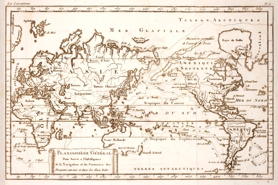
world map
history
historical
history
history
project
historical
history
civitates orbis terrarum. urbium praecipuarum totius mundi. liber quartus
maps of oberwesel by braun & hogenberg
civitates orbis terrarum. urbium praecipuarum totius mundi. liber quartus
maps of mâcon by braun & hogenberg
civitates orbis terrarum. urbium praecipuarum totius mundi. liber quartus
maps of eisleben by braun & hogenberg
civitates orbis terrarum. urbium praecipuarum totius mundi. liber quartus
maps of hamburg by braun & hogenberg
maps of the west-indische compagnie
1665
civitates orbis terrarum. contrafactur und beschreibung von den vornembsten stetten der welt. liber tertius
maps of fortress of charlemont by braun & hogenberg
historical
history
historical
history
historical
history
civitates orbis terrarum. urbium praecipuarum totius mundi. liber quartus
maps of itzehoe by braun & hogenberg
civitates orbis terrarum. urbium praecipuarum totius mundi. liber quartus
1590s maps of denmark
civitates orbis terrarum. urbium praecipuarum totius mundi. liber quartus
16th-century maps showing history
civitates orbis terrarum. urbium praecipuarum totius mundi. liber quartus
maps of krempe by braun & hogenberg
civitates orbis terrarum. urbium praecipuarum totius mundi. liber quartus
16th-century maps showing history
atlas géographique des quatre parties du monde (delisle)
map of scandinavia by guillaume de l'isle (1706)
civitates orbis terrarum. contrafactur und beschreibung von den vornembsten stetten der welt. liber tertius
maps of philippeville by braun & hogenberg
atlas géographique des quatre parties du monde (delisle)
map of scandinavia by guillaume de l'isle (1706)
civitates orbis terrarum. urbium praecipuarum totius mundi. liber quartus
maps of husum by braun & hogenberg
civitates orbis terrarum. urbium praecipuarum totius mundi. liber quartus
maps of dortmund by braun & hogenberg
civitates orbis terrarum. urbium praecipuarum totius mundi. liber quartus
maps of sulmona by braun & hogenberg
civitates orbis terrarum. urbium praecipuarum totius mundi. liber quartus
maps of brixen by braun & hogenberg
civitates orbis terrarum. urbium praecipuarum totius mundi. liber quartus
maps of marchena by braun & hogenberg
maps of guinea by mercator-hondius
history of west africa
civitates orbis terrarum. contrafactur und beschreibung von den vornembsten stetten der welt. liber tertius
maps of arnhem by braun & hogenberg
civitates orbis terrarvm, liber primvs (1577)
maps of mexico city by braun & hogenberg
civitates orbis terrarvm, liber primvs (1577)
maps of dresden by braun & hogenberg
civitates orbis terrarvm, liber primvs (1577)
maps of prague by braun & hogenberg
civitates orbis terrarvm, liber primvs (1577)
maps of mons (hainaut)
civitates orbis terrarvm, liber primvs (1577)
maps of lisbon by braun & hogenberg (1572)
civitates orbis terrarvm, liber primvs (1577)
maps of budapest by braun & hogenberg
atlas geográfico y descripción geográfica y estadística de la república oriental del uruguay (1896)
civitates orbis terrarvm, liber primvs (1577)
maps of genoa by braun & hogenberg
civitates orbis terrarvm, liber primvs (1577)
maps of toledo by braun & hogenberg
atlas geográfico y descripción geográfica y estadística de la república oriental del uruguay (1896)
atlas geográfico y descripción geográfica y estadística de la república oriental del uruguay (1896)
agriculture in uruguay
de praecipvis totivs vniversi vrbibvs, liber secvndvs (1575)
maps of orléans by joris hoefnagel
civitates orbis terrarum. de praecipuis totius universi urbibus. liber secundus
maps of oxford by braun & hogenberg
civitates orbis terrarum. de praecipuis totius universi urbibus. liber secundus
maps of st. gallen by braun & hogenberg
civitates orbis terrarum. de praecipuis totius universi urbibus. liber secundus
maps of conil by braun & hogenberg
civitates orbis terrarum. de praecipuis totius universi urbibus. liber secundus
maps of heraklion by braun & hogenberg
civitates orbis terrarum. de praecipuis totius universi urbibus. liber secundus
maps of vejer by braun & hogenberg
maps in the rijksmuseum amsterdam
old maps of tholen
maps in the stadsarchief amsterdam
dutch golden age painting
media from atlas of mutual heritage on dutch east india company
1682
maps of the arctic ocean
atlas novus (blaeu)
historical
history
historical
history
background
maps
historical
history
historical
history
historical
history
historical
history
maps of ameland
ballum, ameland
cartouches by guillaume delisle
philippe buache
civitates orbis terrarum. de praecipuis totius universi urbibus. liber secundus
maps of orléans by joris hoefnagel
historical
history
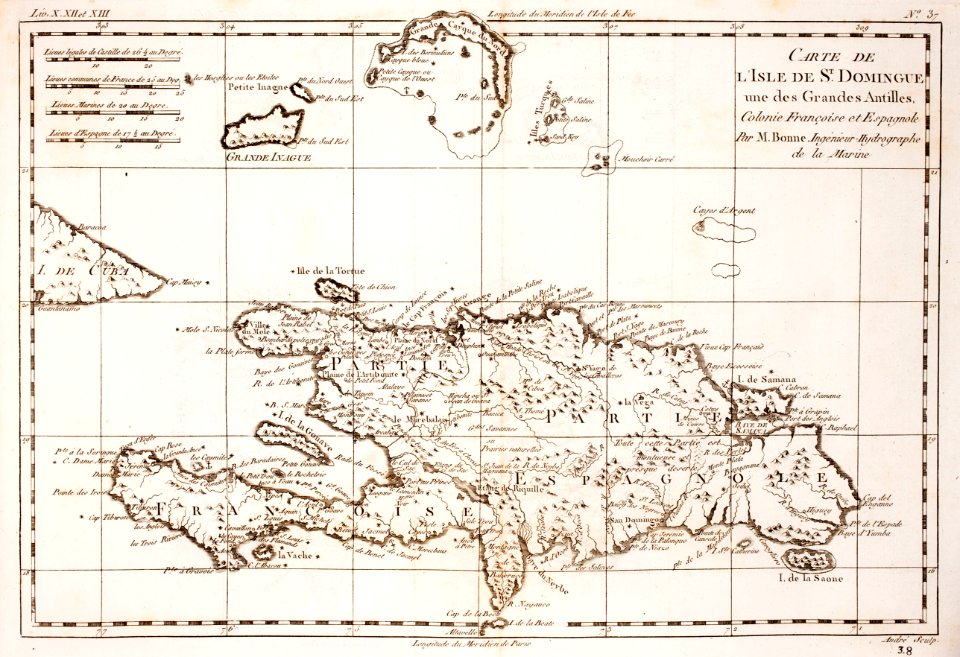
1760s maps of the americas
1760 maps
maps of the ottoman empire by mercator-hondius
de praecipvis totivs vniversi vrbibvs, liber secvndvs (1612)
maps of orléans by joris hoefnagel
de praecipvis totivs vniversi vrbibvs, liber secvndvs (1575)
history of gennep
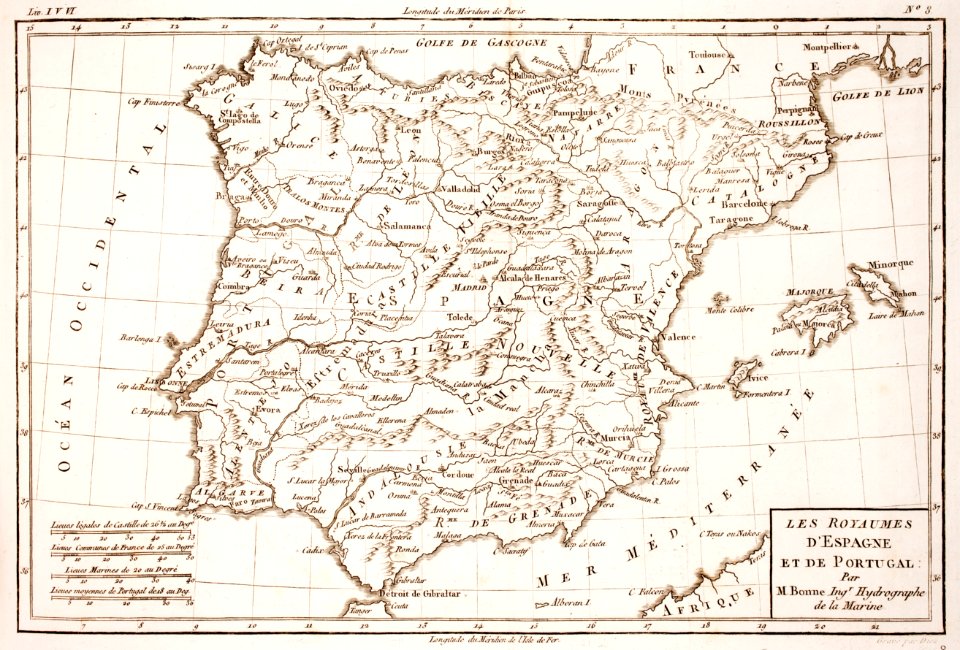
maps of the iberian peninsula by guillaume delisle
1700s maps of the iberian peninsula
historical
history
carte de barbarie, nigritie, guinée par guillaume delisle (1707)
university of washington
maps in the rijksmuseum amsterdam
17th-century celestial maps
historical
history
maps of the iberian peninsula by mercator-hondius
maps by pieter van der keere
atlante geografico del regno di napoli (1812)
old maps of ariano irpino
prints of cartouches in the rijksmuseum amsterdam
maps in the rijksmuseum amsterdam
maps in the rijksmuseum amsterdam
17th-century celestial maps
harmonia macrocosmica, seu, atlas universalis et novus, totius universi creati cosmographiam generalem, et novam exhibens - in quâ omnium totius mundi orbium harmonica constructio, secundum
maps in the library of congress
harmonia macrocosmica, seu, atlas universalis et novus, totius universi creati cosmographiam generalem, et novam exhibens - in quâ omnium totius mundi orbium harmonica constructio, secundum
maps in the library of congress
prints of cartouches in the rijksmuseum amsterdam
maps in the rijksmuseum amsterdam
harmonia macrocosmica, seu, atlas universalis et novus, totius universi creati cosmographiam generalem, et novam exhibens - in quâ omnium totius mundi orbium harmonica constructio, secundum
maps in the library of congress
6401 - 6500 of 7,171
Next page
/ 72